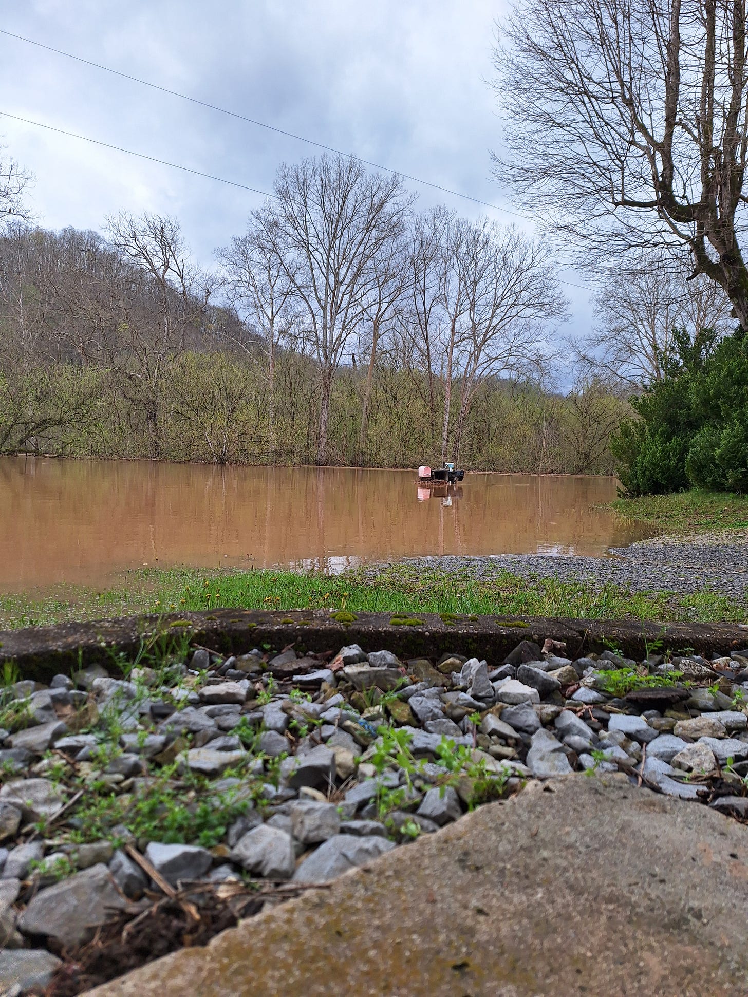
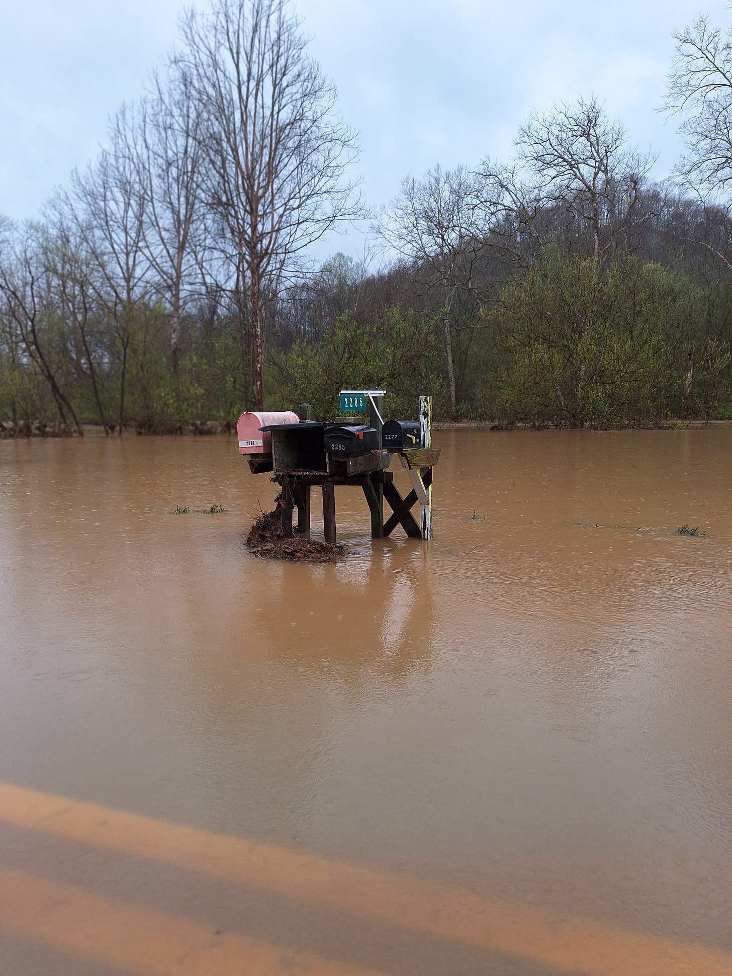
When the creek rises, the first place along our road to disappear under water is at the end of our driveway. Then, we’re on our own until the water recedes. The road closed, for us, is “high water,” not “flooding.” Flooding, for us, starts once the mailboxes disappear. Anything much higher than that, and — well, that’s when it gets serious. The last super-serious flood here was in 1986 (not ‘85), and I cannot even contemplate how much rain would need to fall to reach that depth again.
But I know it very well could.
And I know we’ve been geographically fortunate over the last few decades.
In my 24 years on this farm, I have lost count of the times the road was covered with water. But I recall, very clearly, the times when nearly the entire valley filled, clear to the feet of the hills around us, when my barely-spared neighbor’s houses looked as though they were floating, in some cases less than an inch from a full breach.
Today, we were again, lucky. But around 10 a.m. this morning, the valley nearly full, the waters still running off the hillsides, the remaining flatland soft and soggy, I knew: another rainstorm like yesterday’s at that moment would shift everything from somewhat routine to intensely serious. And it could happen in just a matter of minutes.
Early this morning, just before sunrise, the creek was rising several feet an hour. You wait, you watch, and as it nears the critical point, you calculate rainfall yet to pour into the basin, the behavior of the creek in the past, and the amount of the watershed’s spread lost to displacement by ongoing fill dirt in the floodplain.
When you’re standing a fraction of an inch from a true disaster, you think about the decade of fill downstream at the end of our road, between here and the Little Kanawha River, and between the LK and the Ohio. That’s where all this water has to go.
The day has been overcast, with scattered showers. The creek has receded, the road opened, and the concern has passed — for now. Downstream, 25-35 miles away the Little Kanawha River continues to rise. The Ohio River (at its highest levels in decades just last week), won’t crest for another two days.
Originally from Marietta, Ohio, I’m referred to as a “River Rat.” I know the Ohio Valley and the Ohio River. They’re both wide, and mostly flat. Nothing like the narrow valleys here among the hills. The Ohio River is too big to be unpredictable, too vast to “sneak up” in the night. You know, way ahead of time, that the water is coming for you. There’s nothing you can do to stop it, but almost always, there’s plenty of time to get yourself and your stuff out of its way.
To the Ohio River Basin, an extra five minutes of pouring rain in a single contributing valley makes little difference overall. But to that tight mountain valley? That extra five minutes of rain can be the difference of a fraction of an inch that jumps up in just a few fleeting minutes. I am convinced that Sand Ridge to our west has saved us that extra few minutes of rain more than once, especially in 2016.
When it warms a bit (predicted in two days) I will walk along the streams that pour into the creek that is now a river. I’ll see what they’ve moved and excavated, and examine how they’ve shifted and resettled. We’ll study the creek downstream for potential future creek basin tangles; possible natural dams in the future that might influence all the hydro-dynamics in those calculations we make in our heads…
When the waters rise again.
I’ve sprung a leak in my waders. I’ll have to get a new pair before then.
I feel compelled to add a few notes to this post:
Most established 100-year-flood plains are 50 years out of date and do not take into full consideration the amount of watershed displacement caused by decades of fill. Many properties not listed as floodplain properties should be, and up to 50% of rural valleys are expected to flood within the next 10-15 years.
For towns to be eligible for FEMA flood insurance, they must adopt FEMA floodplain management practices, which require fill in the floodplain for all development. These practices are NOT designed to reduce flooding. They are, in fact, designed to save FEMA from future payouts and worsen flooding in the long term.
Infrastructure like culverts, drains, low-water bridges, etc. are calculated to handle a certain amount of rain over a certain period of time. These construction/development standards are woefully inadequate for significant rain events. In some areas, the underground drains created to carry off rainwater are filled with mud, sediment, and debris. If you live near a culvert, or canal, or are dependent on water-flow management systems, you also need to be diligent.
The majority of flood-prone communities are shut off from all assistance early on during the disaster, and long after the waters recede. On average, it will take several days for any aid to arrive. BE PREPARED. And for heaven’s sake — turn around, don’t drown. Do NOT drive through high water.


Yes, this was the worst flooding here since 2016, although not as deep it was more widespread, I had to call my neighbor 1/2 mile away to come on his 4x4 and jump out get in my car and back it up the drive to the road, it was up under to the bumper!